Burgos, La Union
Burgos Disdis | |
|---|---|
| Municipality of Burgos | |
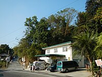
 Burgos town center along Naguilian Road | |
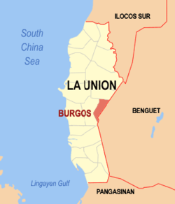
 Map of La Union with Burgos highlighted | |
Location within the Philippines | |
| Coordinates: 16°31′30″N 120°27′30″E / 16.525°N 120.4583°E | |
| Country | Philippines |
| Region | Ilocos Region |
| Province | La Union |
| District | 2nd district |
| Named for | José Burgos |
| Barangays | 12 (see Barangays) |
| Government | |
| • Type | Sangguniang Bayan |
| • Mayor | Delfin C. Comedis Jr. |
| • Vice Mayor | Annie A.Patinglag |
| • Representative | Dante S. Garcia |
| • Municipal Council | Members |
| • Electorate | 6,733 voters (2022) |
| Area | |
• Total | 70.80 km2 (27.34 sq mi) |
| Elevation | 336 m (1,102 ft) |
| Highest elevation | 1,010 m (3,310 ft) |
| Lowest elevation | 21 m (69 ft) |
| Population (2020 census)[3] | |
• Total | 9,006 |
| • Density | 130/km2 (330/sq mi) |
| • Households | 2,145 |
| Economy | |
| • Income class | 5th municipal income class |
| • Poverty incidence | 10.69 |
| • Revenue | ₱ 69.93 million (2020) |
| • Assets | ₱ 243.4 million (2020) |
| • Expenditure | ₱ 76.96 million (2020) |
| • Liabilities | ₱ 19.51 million (2020) |
| Service provider | |
| • Electricity | La Union Electric Cooperative (LUELCO) |
| Time zone | UTC+8 (PST) |
| ZIP code | 2510 |
| PSGC | |
| IDD : area code | +63 (0)72 |
| Native languages | Ilocano Tagalog |
| Website | www |
Burgos, officially the Municipality of Burgos (Ilocano: Ili ti Burgos; Filipino: Bayan ng Burgos), is a 5th class municipality in La Union, Philippines, named after the Filipino martyr Father Jose Burgos. It is the least populated municipality in the province, with a population of 9,006 according to the 2020 census.[3] The town is known for its production of colored soft brooms made from tiger grass.
Geographically, Burgos is located 29 kilometers from the provincial capital, San Fernando City, and 28 kilometers from Baguio City. It is 278 kilometers from Metro Manila.
History
Burgos, has its roots in the swampy region once called "Desdes" or "Disdis," a Nabaloi word meaning "to roll up pants or sleeves," which reflected the swampy nature of the land. The name aptly described the locals' need to wade through the area's numerous springs, creeks, and rivers that meandered through the region. In the Iloco, "Desdes" also means "big spring," further emphasizing the significance of the water sources in the region's early identity.[5][6]
The first inhabitants of this swampy land were the Ibalois (Mangatibekbek) from Atok and Kapangan in Benguet, along with the Kankanaeys (Mangalkali) and later joined by the Ilocanos from towns like Vigan, Candon in Ilocos Sur, and other parts of La Union (San Fernando, Sto. Tomas and Naguilian) and Pangasinan (Dagupan). These diverse groups lived in peace for decades, forging a strong sense of community despite their varied backgrounds. The integration of cultures between the highlanders and lowlanders gave the town a unique identity that would persist through the years.
During the Spanish period, the region was divided into two major settlements: Rancheria Disdis in the northwestern part and Rancheria Galiano in the southern part. For much of its early history, the area was a part of the larger administrative territories in Benguet. However, in 1903, the Philippine Commission passed Act No. 662, which realigned the boundaries between La Union and Benguet. As a result, Rancheria Disdis became part of La Union, while Rancheria Galiano remained under Benguet’s jurisdiction. Over the next few decades, the borders were redrawn several times, and by 1920, the boundary revisions returned the area of Disdis to La Union.
The formation of Burgos as a distinct administrative entity came on November 27, 1925, with the issuance of Executive Order No. 54 by Governor General Leonard Wood. This order formally created the Municipal District of Burgos under the province of La Union, comprising several barrios: Pappa, Bilis Northwest, Ribsuan, Libtong Norte, and Bayabas West. The district was named in honor of the Filipino martyr Father Jose Burgos, a prominent figure in the struggle for Filipino rights during the Spanish colonial period. According to local accounts, Father Burgos once sought refuge in the area while fleeing Spanish persecution and officiated a mass at Sitio Domingo in Agpay, an event that left a lasting impression on the community.
Leadership of the newly established district was entrusted to Don Polon Bentrez, who is widely regarded as the founder of the municipality of Burgos. He was appointed as the first municipal president and oversaw the construction of a simple town hall, or presidencia, made of bamboo and cogon grass in Barrio Ribsuan (now part of Naguilian). One of Don Polon’s most notable contributions was the distribution and allocation of lands to the early settlers, a gesture that fostered stability and growth in the community. Tragically, his leadership was cut short in 1929 when he sustained fatal injuries during a boundary inspection in Bantay Siam, a remote area in Barrio Libtong. After his death, his vice president, Don Cornelio Abenes, assumed the leadership role until 1930, when Don Juan Abellada became the first elected municipal district mayor.
The district continued to evolve, with the creation of additional barrios in the 1930s, including Cauayan, Tumapoc, Linuan, Delles, and Central. When Barrio Ribsuan was later annexed to the municipality of Naguilian, the seat of government was moved to Central. By the late 1960s, the seat of governance was once again relocated, this time to New Poblacion, marking the town’s growth and its quest for a more central and accessible administrative hub. Around the same time, more barrios were formed, such as Agpay, Dalacdac (from Cauayan), Imelda (from Libtong), New Poblacion (from Bilis), and Upper Tumapoc (from Tumapoc).
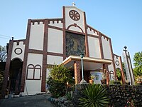
In 1960, the transformation of Burgos from a municipal district into a regular municipality was formally recognized, a milestone that cemented its place as an independent and thriving community in La Union. Despite its early challenges, the town’s development over the years is a testament to the perseverance and unity of its people. Today, Burgos stands not only as a symbol of the harmonious blending of different cultures but also as a living legacy of those who came before, particularly Father Jose Burgos, whose memory continues to inspire the town that bears his name.[6]
Geography
Burgos, La Union, is a highland municipality with a predominantly hilly terrain, covering a total land area of 7,082 hectares. It is bordered by Bagulin to the north, Naguilian to the south and west, and Sablan, Benguet, to the east. The town is traversed by the Naguilian River, with 11.40 kilometers of riverbanks. The land classification includes 2,307.93 hectares of certified Alienable and Disposable (A&D) land. In terms of land use, Burgos has 2,263.93 hectares of agricultural areas, 43.51 hectares of bare land, 24.11 hectares of grasslands, 114.79 hectares of wetlands, 536.59 hectares of forest areas (with 507.59 hectares of public forest), and 48.81 hectares of built-up areas.
Barangays
Burgos is politically subdivided into 12 barangays, with 9 upland barangays and 3 lowland barangays. Each barangay is further divided into puroks, and some have sitios. Each barangay is led by a Chairman and its Councilors, while the Sangguniang Kabataan, represented by its Councilor, focuses on youth representation.
- Agpay
- Bilis
- Caoayan
- Dalacdac
- Delles
- Imelda
- Libtong
- Linuan
- New Poblacion
- Old Poblacion
- Lower Tumapoc
- Upper Tumapoc
Climate
| Climate data for Burgos, La Union | |||||||||||||
|---|---|---|---|---|---|---|---|---|---|---|---|---|---|
| Month | Jan | Feb | Mar | Apr | May | Jun | Jul | Aug | Sep | Oct | Nov | Dec | Year |
| Mean daily maximum °C (°F) | 28 (82) |
29 (84) |
30 (86) |
31 (88) |
29 (84) |
29 (84) |
27 (81) |
27 (81) |
27 (81) |
28 (82) |
29 (84) |
28 (82) |
29 (83) |
| Mean daily minimum °C (°F) | 18 (64) |
19 (66) |
21 (70) |
23 (73) |
23 (73) |
23 (73) |
23 (73) |
23 (73) |
23 (73) |
22 (72) |
20 (68) |
19 (66) |
21 (70) |
| Average precipitation mm (inches) | 42 (1.7) |
48 (1.9) |
74 (2.9) |
110 (4.3) |
269 (10.6) |
275 (10.8) |
362 (14.3) |
325 (12.8) |
330 (13.0) |
306 (12.0) |
126 (5.0) |
61 (2.4) |
2,328 (91.7) |
| Average rainy days | 11.2 | 12.0 | 17.1 | 21.2 | 27.1 | 26.8 | 28.1 | 27.0 | 26.0 | 24.5 | 17.7 | 12.4 | 251.1 |
| Source: Meteoblue[7] | |||||||||||||
Demographics
| Year | Pop. | ±% p.a. |
|---|---|---|
| 1903 | 8 | — |
| 1918 | 2,256 | +45.66% |
| 1939 | 1,774 | −1.14% |
| 1948 | 1,348 | −3.01% |
| 1960 | 2,124 | +3.86% |
| 1970 | 3,160 | +4.05% |
| 1975 | 3,570 | +2.48% |
| 1980 | 4,149 | +3.05% |
| 1990 | 5,410 | +2.69% |
| 1995 | 6,086 | +2.23% |
| 2000 | 6,748 | +2.24% |
| 2007 | 8,261 | +2.83% |
| 2010 | 7,850 | −1.84% |
| 2015 | 8,067 | +0.52% |
| 2020 | 9,006 | +2.19% |
| Source: Philippine Statistics Authority[8][9][10][11] | ||
According to the 2020 Philippine Statistics Authority census, the population of Burgos, La Union, is recorded at 9,006 individuals.[3] The population density is calculated at 130 inhabitants per square kilometer, or 340 inhabitants per square mile. The official language of the town is Iloco, while Ibaloi and Kankanaey are also spoken among the residents. The growth rate for the town is 1.63% with the largest age group is children aged 5 to 9, while the senior population (70 years and above) is the smallest.
In terms of religious affiliation, Christianity is the predominant faith, with Roman Catholics being the majority, followed by Iglesia ni Cristo and various other denominations. The literacy rate within Burgos stands at 98.83%. The total number of households in the town is 1,596.
The labor force consists of 5,491 individuals. The poverty incidence in Burgos is reported at 53.15%, with the magnitude of poor families at 34.82% and the magnitude of the poor population at 37.18%.
Economy
Burgos, La Union, possesses an economy primarily driven by the agricultural sector, with key crops including rice, corn, and a variety of fruits and vegetables. The town is also engaged in fishing, trade, and small-scale industries. As of the latest statistics, the employment distribution in Burgos is heavily skewed towards agriculture, which accounts for 96% of the workforce, while industry and services represent 1.8% and 2.06%, respectively. According to the 2021 census conducted by the Philippine Statistics Authority, the poverty incidence rate in the town stands at 10.69%.
As according to 2024 DTI Cities and Municipalities Competitive Index report, the economy of Burgos is characterized by a moderate level of economic dynamism, ranking 161st with a score of 4.18. The town shows strengths in local economy growth (60th place) and cost of living (20th place), while areas like safety compliance (223rd) and employment generation (180th) present challenges. There are also notable efforts in productivity and presence of business and professional organizations, which rank 166th and 44th, respectively. The town's focus is on improving local economic conditions while managing the cost of doing business and financial deepening.[12]
Poverty incidence of Burgos
10 20 30 40 50 2006 40.80 2009 26.20 2012 16.70 2015 10.11 2018 4.03 2021 10.69 Source: Philippine Statistics Authority[13][14][15][16][17][18][19][20] |
Government
Local government
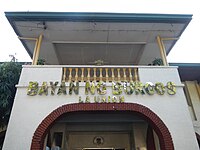
Burgos, belonging to the second congressional district of the province of La Union, is governed by a mayor designated as its local chief executive and by a municipal council as its legislative body in accordance with the Local Government Code. The mayor, vice mayor, and the councilors are elected directly by the people through an election which is being held every three years.
Elected officials
| Position | Name |
|---|---|
| Congressman | Dante S. Garcia |
| Mayor | Delfin C. Comedis, Jr. |
| Vice-Mayor | Annie A. Patinglag |
| Councilors | Mario C. Martinez |
| Efren A. Hidalgo | |
| Marlon C. Gumba | |
| Dante C. Cabinto | |
| Betty Jean L. Arsitio | |
| Domingo G. Abansi | |
| Alano N. Gascon | |
| Daniel N. Nisperos |
Major roads
Gallery
|
References
- ^ Municipality of Burgos | (DILG)
- ^ "2015 Census of Population, Report No. 3 – Population, Land Area, and Population Density" (PDF). Philippine Statistics Authority. Quezon City, Philippines. August 2016. ISSN 0117-1453. Archived (PDF) from the original on May 25, 2021. Retrieved July 16, 2021.
- ^ a b c Census of Population (2020). "Region I (Ilocos Region)". Total Population by Province, City, Municipality and Barangay. Philippine Statistics Authority. Retrieved 8 July 2021.
- ^ "PSA Releases the 2021 City and Municipal Level Poverty Estimates". Philippine Statistics Authority. 2 April 2024. Retrieved 28 April 2024.
- ^ Provincial Government of La Union. "Municipality of Burgos History".
- ^ a b "History | Burgos, La Union". Retrieved 2024-10-10.
- ^ "Burgos: Average Temperatures and Rainfall". Meteoblue. Retrieved 26 April 2020.
- ^ Census of Population (2015). "Region I (Ilocos Region)". Total Population by Province, City, Municipality and Barangay. Philippine Statistics Authority. Retrieved 20 June 2016.
- ^ Census of Population and Housing (2010). "Region I (Ilocos Region)" (PDF). Total Population by Province, City, Municipality and Barangay. National Statistics Office. Retrieved 29 June 2016.
- ^ Censuses of Population (1903–2007). "Region I (Ilocos Region)". Table 1. Population Enumerated in Various Censuses by Province/Highly Urbanized City: 1903 to 2007. National Statistics Office.
- ^ "Province of La Union". Municipality Population Data. Local Water Utilities Administration Research Division. Retrieved 17 December 2016.
- ^ "Cities and Municipalities Competitiveness Index". CMCI. Retrieved 2024-10-10.
- ^ "Poverty incidence (PI):". Philippine Statistics Authority. Retrieved December 28, 2020.
- ^ "Estimation of Local Poverty in the Philippines" (PDF). Philippine Statistics Authority. 29 November 2005.
- ^ "2003 City and Municipal Level Poverty Estimates" (PDF). Philippine Statistics Authority. 23 March 2009.
- ^ "City and Municipal Level Poverty Estimates; 2006 and 2009" (PDF). Philippine Statistics Authority. 3 August 2012.
- ^ "2012 Municipal and City Level Poverty Estimates" (PDF). Philippine Statistics Authority. 31 May 2016.
- ^ "Municipal and City Level Small Area Poverty Estimates; 2009, 2012 and 2015". Philippine Statistics Authority. 10 July 2019.
- ^ "PSA Releases the 2018 Municipal and City Level Poverty Estimates". Philippine Statistics Authority. 15 December 2021. Retrieved 22 January 2022.
- ^ "PSA Releases the 2021 City and Municipal Level Poverty Estimates". Philippine Statistics Authority. 2 April 2024. Retrieved 28 April 2024.
- ^ "2019 National and Local Elections" (PDF). Commission on Elections. Archived (PDF) from the original on 2020-10-06. Retrieved March 6, 2022.


