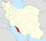
Bandar Deylam
Bandar-e Deylam Persian: بندر ديلم | |
|---|---|
City | |
| Coordinates: 30°03′18″N 50°09′55″E / 30.05500°N 50.16528°E[1] | |
| Country | Iran |
| Province | Bushehr |
| County | Deylam |
| District | Central |
| Population (2016)[2] | |
• Total | 25,730 |
| Time zone | UTC+3:30 (IRST) |
Bandar Deylam (Persian: بندر ديلم)[a] is a port city in the Central District of Deylam County, Bushehr province, Iran, serving as capital of both the county and the district.[4]
Demographics
Population
At the time of the 2006 National Census, the city's population was 19,829 in 4,426 households.[5] The following census in 2011 counted 22,393 people in 5,603 households.[6] The 2016 census measured the population of the city as 25,730 people in 7,359 households.[2]
On 16 February 2005 a large explosion was reported close to the site of a newly built nuclear power plant. Iranian officials later announced that the explosion was caused by construction work on a dam at Kowsar, near Deylam.[citation needed]
Climate
| Climate data for Bandar Deylam (2001-2005) | |||||||||||||
|---|---|---|---|---|---|---|---|---|---|---|---|---|---|
| Month | Jan | Feb | Mar | Apr | May | Jun | Jul | Aug | Sep | Oct | Nov | Dec | Year |
| Mean daily maximum °C (°F) | 18.0 (64.4) |
20.7 (69.3) |
25.8 (78.4) |
30.7 (87.3) |
36.9 (98.4) |
39.5 (103.1) |
40.3 (104.5) |
39.3 (102.7) |
37.0 (98.6) |
33.9 (93.0) |
26.3 (79.3) |
20.1 (68.2) |
30.7 (87.3) |
| Daily mean °C (°F) | 14.0 (57.2) |
15.9 (60.6) |
20.0 (68.0) |
25.1 (77.2) |
30.6 (87.1) |
33.4 (92.1) |
34.6 (94.3) |
33.7 (92.7) |
30.5 (86.9) |
27.0 (80.6) |
20.8 (69.4) |
16.0 (60.8) |
25.1 (77.2) |
| Mean daily minimum °C (°F) | 10.0 (50.0) |
11.1 (52.0) |
14.2 (57.6) |
19.6 (67.3) |
24.3 (75.7) |
27.3 (81.1) |
28.9 (84.0) |
28.0 (82.4) |
24.0 (75.2) |
20.1 (68.2) |
15.2 (59.4) |
11.9 (53.4) |
19.6 (67.2) |
| Average precipitation mm (inches) | 123.7 (4.87) |
8.9 (0.35) |
24.6 (0.97) |
11.5 (0.45) |
0.8 (0.03) |
0.0 (0.0) |
0.0 (0.0) |
0.0 (0.0) |
0.0 (0.0) |
0.5 (0.02) |
30.6 (1.20) |
128.8 (5.07) |
329.4 (12.96) |
| Average relative humidity (%) | 78 | 62 | 54 | 58 | 50 | 48 | 49 | 57 | 55 | 56 | 60 | 73 | 58 |
| Source: IRIMO[7] | |||||||||||||
See also
Notes
References
- ^ OpenStreetMap contributors (26 August 2024). "Bandar Deylam, Deylam County" (Map). openstreetmap.org (OpenStreetMap) (in Persian). Retrieved 26 August 2024.
- ^ a b Census of the Islamic Republic of Iran, 1395 (2016): Bushehr Province. amar.org.ir (Report) (in Persian). The Statistical Center of Iran. Archived from the original (Excel) on 3 August 2017. Retrieved 19 December 2022.
- ^ Bandar Deylam can be found at GEOnet Names Server, at this link, by opening the Advanced Search box, entering "-3055112" in the "Unique Feature Id" form, and clicking on "Search Database".
- ^ Habibi, Hassan (c. 2024) [Approved 22 July 1374]. Divisional reforms in Bushehr province. lamtakam.com (Report) (in Persian). Ministry of the Interior, Political and Defense Commission of the Government Council. Notification 93808T/907. Archived from the original on 25 April 2024. Retrieved 25 April 2024 – via Lam ta Kam.
- ^ Census of the Islamic Republic of Iran, 1385 (2006): Bushehr Province. amar.org.ir (Report) (in Persian). The Statistical Center of Iran. Archived from the original (Excel) on 20 September 2011. Retrieved 25 September 2022.
- ^ Census of the Islamic Republic of Iran, 1390 (2011): Bushehr Province. irandataportal.syr.edu (Report) (in Persian). The Statistical Center of Iran. Archived from the original (Excel) on 3 April 2023. Retrieved 19 December 2022 – via Iran Data Portal, Syracuse University.
- ^ "Statistics of 200 synoptic stations: Bandar Daylam (40846)" بندر دیلم. Chaharmahalmet (in Persian). Iran Meteorological Organization. Retrieved 12 February 2025.


