Auburn Lake Trails, California
Auburn Lake Trails | |
|---|---|
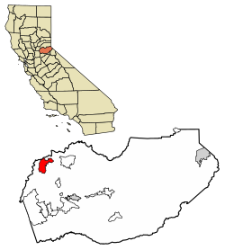
 Location of Auburn Lake Trails in El Dorado County, California. | |
| Coordinates: 38°54′52″N 120°57′09″W / 38.91444°N 120.95250°W | |
| Country | |
| State | |
| County | El Dorado County |
| Area | |
• Total | 3,600 [1] acres (33.02 km2) |
| • Land | 12.73 sq mi (32.96 km2) |
| • Water | 0.02 sq mi (0.06 km2) 0.17% |
| Elevation | 1,916 ft (584 m) |
| Population (2020) | |
• Total | 3,388 |
| • Density | 266.21/sq mi (102.78/km2) |
| Time zone | UTC-8 (Pacific (PST)) |
| • Summer (DST) | UTC-7 (PDT) |
| ZIP code | 95614[4] |
| Area code | 530 |
| GNIS feature IDs | 1733728, 2582982 |
Auburn Lake Trails is a census-designated place[5] in El Dorado County, California.[3] It lies at an elevation of 1916 feet (584 m).[3] It is a gated community with 23 miles (37 km) of horse trails.[6] As of the 2010 census, the population was 3,426.
Demographics
| Census | Pop. | Note | %± |
|---|---|---|---|
| 2020 | 3,388 | — | |
| U.S. Decennial Census[7] 2010[8] | |||
Auburn Lake Trails first appeared as a census designated place in the 2010 U.S. Census.[8]
Auburn Lake Trails had a population of 3,426 as of the 2010 census. The population density was 268.7 inhabitants per square mile (103.7/km2). The racial makeup of Auburn Lake Trails was 3,190 (93.1%) White, 6 (0.2%) African American, 28 (0.8%) Native American, 36 (1.1%) Asian, 5 (0.1%) Pacific Islander, 45 (1.3%) from other races, and 116 (3.4%) from two or more races. There were 208 people of Hispanic or Latino background or another race (6.1%).[9]
The whole population lived in households; no one lived in non-institutionalized group quarters, and no one was institutionalized. There were 1,366 households: 383 (28.0%) had children under the age of 18 living in them, 891 (65.2%) were opposite-sex married couples living together, 90 (6.6%) had a female householder with no husband present, and 47 (3.4%) had a male householder with no wife present. There were 62 (4.5%) unmarried opposite-sex partnerships, 18 (1.3%) same-sex married couples or partnerships, 266 households (19.5%) composed of one person and 111 (8.1%) having someone living alone who was 65 or older. The average household size was 2.51. There were 1,028 families (75.3% of households). The average family size was 2.86.
The age distribution was 720 people (21.0%) under the age of 18, 185 people (5.4%) aged 18 to 24, 631 people (18.4%) aged 25 to 44, 1,294 people (37.8%) aged 45 to 64, and 596 people (17.4%) who were 65 or older. The median age was 48.3 years. For every 100 females, there were 93.7 males. For every 100 females age 18 and over, there were 94.7 males.
There were 1,486 housing units at an average density of 116.6 per square mile (45.0/km2), of which 1,366 were occupied - 1,209 (88.5%) by the owners and 157 (11.5%) by renters. The homeowner vacancy rate was 2.6%. The rental vacancy rate was 3.1%. Owner-occupied units housed 3,017 people (88.1% of the population), while 409 people (11.9%) lived in rental housing units.
References
- ^ "Auburn Lake Trails Fire Safe Council". Retrieved February 7, 2023.
- ^ "2020 U.S. Gazetteer Files". United States Census Bureau. Retrieved October 30, 2021.
- ^ a b c "Auburn Lake Trails". Geographic Names Information System. United States Geological Survey, United States Department of the Interior.
- ^ "Auburn Lake Trails CA ZIP Code". zipdatamaps.com. 2023. Retrieved January 26, 2023.
- ^ "Auburn Lake Trails Census Designated Place". Geographic Names Information System. United States Geological Survey, United States Department of the Interior.
- ^ "Auburn Lake Trails website". Retrieved May 5, 2009.
- ^ "Decennial Census by Decade". United States Census Bureau.
- ^ a b "2010 Census of Population - Population and Housing Unit Counts - California" (PDF). United States Census Bureau.
- ^ "2010 Census Interactive Population Search: CA - Auburn Lake Trails CDP". U.S. Census Bureau. Archived from the original on July 15, 2014. Retrieved July 12, 2014.


