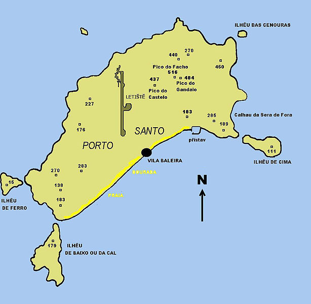
Datei:Mapa Porto Santo.JPG

Größe dieser Vorschau: 614 × 600 Pixel. Weitere Auflösungen: 246 × 240 Pixel | 492 × 480 Pixel | 786 × 768 Pixel | 1.109 × 1.083 Pixel
Originaldatei (1.109 × 1.083 Pixel, Dateigröße: 104 KB, MIME-Typ: image/jpeg)
Dateiversionen
Klicke auf einen Zeitpunkt, um diese Version zu laden.
| Version vom | Vorschaubild | Maße | Benutzer | Kommentar | |
|---|---|---|---|---|---|
| aktuell | 04:33, 25. Okt. 2010 |  | 1.109 × 1.083 (104 KB) | JotaCartas | correct North |
| 04:25, 25. Okt. 2010 |  | 1.109 × 1.083 (233 KB) | JotaCartas | Reverted to version as of 00:42, 25 October 2010 | |
| 04:08, 25. Okt. 2010 |  | 1.109 × 1.083 (104 KB) | JotaCartas | correct north; + translation | |
| 01:42, 25. Okt. 2010 |  | 1.109 × 1.083 (233 KB) | JotaCartas | correct spelling (Ferro) | |
| 13:49, 27. Mär. 2009 |  | 1.109 × 1.083 (81 KB) | File Upload Bot (Magnus Manske) | {{BotMoveToCommons|cs.wikipedia|year={{subst:CURRENTYEAR}}|month={{subst:CURRENTMONTHNAME}}|day={{subst:CURRENTDAY}}}} {{Information |Description={{cs|Mapa ostrova Porto Santo.}} |Source=Transferred from [http://cs.wikipedia.org cs.wikipedia]; transferre |
Dateiverwendung
Die folgenden 4 Seiten verwenden diese Datei:
Globale Dateiverwendung
Die nachfolgenden anderen Wikis verwenden diese Datei:
- Verwendung auf br.wikipedia.org
- Verwendung auf cs.wikipedia.org
- Verwendung auf da.wikipedia.org
- Verwendung auf eo.wikipedia.org
- Verwendung auf fi.wikipedia.org
- Verwendung auf frr.wikipedia.org
- Verwendung auf nl.wikipedia.org
- Verwendung auf uk.wikipedia.org

