
Datei:Map of Alaska highlighting Kenai Peninsula Borough.svg

Größe der PNG-Vorschau dieser SVG-Datei: 800 × 423 Pixel. Weitere aus SVG automatisch erzeugte PNG-Grafiken in verschiedenen Auflösungen: 320 × 169 Pixel | 640 × 338 Pixel | 1.024 × 541 Pixel | 1.280 × 677 Pixel | 2.560 × 1.353 Pixel | 1.470 × 777 Pixel
Originaldatei (SVG-Datei, Basisgröße: 1.470 × 777 Pixel, Dateigröße: 644 KB)
![]()
Diese Datei und die Informationen unter dem roten Trennstrich werden aus dem zentralen Medienarchiv Wikimedia Commons eingebunden.
![]()
Beschreibung
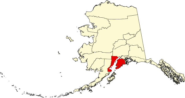
| Beschreibung | English: This is a locator map showing Kenai Peninsula Borough in Alaska |
| Datum | |
| Quelle |
Eigenes Werk: English: The maps use data from nationalatlas.gov, specifically countyp020.tar.gz on the Raw Data Download page. The maps also use state outline data from statesp020.tar.gz. The Florida maps use hydrogm020.tar.gz to display Lake Okeechobee. |
| Urheber | David Benbennick |
Lizenz
| Ich, der Urheberrechtsinhaber dieses Werkes, veröffentliche es als gemeinfrei. Dies gilt weltweit. In manchen Staaten könnte dies rechtlich nicht möglich sein. Sofern dies der Fall ist: Ich gewähre jedem das bedingungslose Recht, dieses Werk für jedweden Zweck zu nutzen, es sei denn, Bedingungen sind gesetzlich erforderlich. |
Dateiversionen
Klicke auf einen Zeitpunkt, um diese Version zu laden.
| Version vom | Vorschaubild | Maße | Benutzer | Kommentar | |
|---|---|---|---|---|---|
| aktuell | 21:10, 25. Jun. 2024 | | 1.470 × 777 (644 KB) | Nux | uniform colors with good contrast |
| 21:07, 25. Jun. 2024 |  | 1.470 × 777 (644 KB) | Nux | uniform colors with good contrast | |
| 00:16, 18. Jun. 2024 |  | 1.470 × 777 (338 KB) | Nux | fix rendering (remove clipping) | |
| 00:12, 18. Jun. 2024 |  | 1.470 × 777 (338 KB) | Nux | fix rendering (remove clipping) | |
| 20:26, 5. Mär. 2006 |  | 1.470 × 777 (338 KB) | David Benbennick | {{subst:User:Dbenbenn/clm|county=Kenai Peninsula Borough|state=Alaska|type=borough and census area}} |
Dateiverwendung
Die folgenden 39 Seiten verwenden diese Datei:
- Anchor Point
- Bear Creek (Alaska)
- Beluga (Alaska)
- Clam Gulch
- Cohoe
- Cooper Landing
- Crown Point (Alaska)
- Diamond Ridge (Alaska)
- Fox River (Alaska)
- Fritz Creek (Alaska)
- Funny River (Alaska)
- Halibut Cove (Alaska)
- Happy Valley (Alaska)
- Homer (Alaska)
- Hope (Alaska)
- Kachemak
- Kalifornsky
- Kasilof
- Kenai
- Kenai Peninsula Borough
- Lowell Point
- Moose Pass
- Nanwalek
- Nikiski
- Nikolaevsk
- Ninilchik
- Point Possession
- Port Graham (Alaska)
- Primrose (Alaska)
- Ridgeway (Alaska)
- Salamatof
- Seldovia
- Seldovia Village
- Seward (Alaska)
- Soldotna
- Sterling (Alaska)
- Sunrise (Alaska)
- Tyonek
- Vorlage:Navigationsleiste Orte im Kenai Peninsula Borough
Globale Dateiverwendung
Die nachfolgenden anderen Wikis verwenden diese Datei:
- Verwendung auf ar.wikipedia.org
- Verwendung auf bpy.wikipedia.org
- Verwendung auf ca.wikipedia.org
- Kachemak
- Anchor Point (Alaska)
- Bear Creek (Alaska)
- Clam Gulch
- Cohoe
- Cooper Landing
- Crown Point (Alaska)
- Diamond Ridge
- Fox River
- Fritz Creek
- Funny River
- Halibut Cove
- Happy Valley (Alaska)
- Homer (Alaska)
- Hope (Alaska)
- Kalifornsky
- Kasilof
- Kenai (ciutat d'Alaska)
- Lowell Point
- Miller Landing
- Moose Pass
- Nanwalek
- Nikiski
- Nikolaevsk
- Ninilchik
- Port Graham
- Primrose (Alaska)
- Ridgeway (Alaska)
- Salamatof
- Seldovia
- Seldovia Village
- Seward (Alaska)
- Soldotna
- Sterling (Alaska)
- Sunrise (Alaska)
- Tyonek
- Plantilla:Borough de la Península de Kenai
- Llista de boroughs i àrees censals d'Alaska
- Verwendung auf ceb.wikipedia.org
- Verwendung auf ce.wikipedia.org
- Verwendung auf cy.wikipedia.org
- Verwendung auf da.wikipedia.org
- Verwendung auf en.wikipedia.org
Weitere globale Verwendungen dieser Datei anschauen.